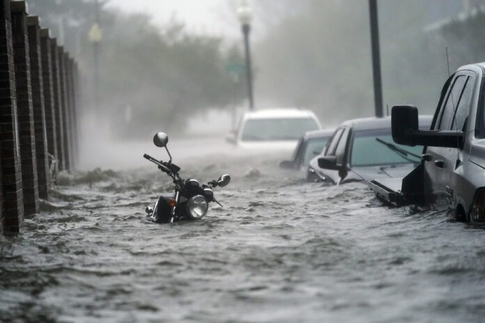
Sea level rise is accelerating along the coasts of the southeastern United States, threatening people, natural environments and infrastructure, new studies show.
According to the latest data, millions of coastal residents are likely to experience climate variations – including hurricanes – more devastating than those of previous decades. Major cities like Houston, Miami, Charleston and New Orleans are at risk.
More concretely, the level of the waters bordering the coasts of the American Southeast and those of the Gulf of Mexico would have risen by 12.7 cm since 2010, indicates a recent study by the University of Arizona. This increase is much greater than the average of previous decades.
“This whole region is feeling the impacts of this phenomenon,” author Jianjun Yin, a professor of geosciences, told The Washington Post. The water level recorded after Hurricane Ian [September 2022] is a record high due to the combination of high sea level and storm surge. »
Ian’s passage, it should be remembered, devastated part of the west coast of Florida, leaving damage estimated at 113 billion US dollars.
Another study by the federal agency National Oceanic and Atmospheric Administration (NOAA) also indicates an average sea level rise of 0.5 in (1.27 cm) per year between 2010 and 2022 in the Pensacola, Florida area. By comparison, the recorded average was 1/12 inch (0.21 cm) per year between 1923 and 2009.
The Washington Post adds, however, that the findings made over a relatively short period (2010-2022) leave some scientists skeptical. “Researchers typically prefer to rely on data spanning decades,” it says.
“It is obvious that we must remain cautious about the generalization of a trend observed over only a dozen years”, indicates, in an exchange of e-mails, Pascale Biron, full professor in the department of geography, urban planning and environment of the ‘Concordia University.
It indicates that it is necessary to take into account certain “natural variability” such as the phenomenon of La niña which can “cause a drop in sea levels”.
Ms. Biron also refers us to recent NASA research concluding that over the past 30 years, sea level rise caused by human activities has been 10 times higher than natural rise.
INSERT NASA GRAPHIC HERE
Canada, which has 226,000 km of coastline, is not spared. For example, a Geological Survey of Canada document published in 2021 indicated that the level of the oceans could rise by 175 cm by 2100 in certain regions.
Full professor at the Faculty of Planning at the University of Montreal and specialist in urban vulnerability, Isabelle Thomas finds “not much innovative” in the new studies, indicating that we already know that “these territories suffer of subsidence”.
On the other hand, she believes that “very interesting initiatives have been taken” on the redevelopment of cities, types of buildings and types of practices so that “citizens adapt to possible floods”.
She gives an example of the case of New Orleans, where she lived and taught and which learned lessons following the devastating passage of Hurricane Katrina in August 2005. Among the green and blue infrastructures put in place to Preventing further flooding, Ms. Thomas points to the Gentilly district, one of whose parks, Mirabeau Water Garden, can retain and drain more than 10 million gallons (37.8 million liters) of hurricane water.
Another trial program offers land swaps for residents in high-risk areas.
That’s all good, but shouldn’t we just leave the shores and return them to nature? “It’s a very relevant question and one that arises,” replies Ms. Thomas. The problem is that we have urbanized our coasts a lot! If we do buy-back programs, it is very important that they be in collaboration with citizens to give them the possibility of relocating to pleasant places. For families who have given themselves homes from one generation to the next, it is important to get it right. »
Washington could make a unilateral decision next summer to force seven Southwestern states to adopt a plan to reduce water use from the Colorado River. The river supplies nearly 40 million Americans and two states in Mexico, in addition to irrigating some 5.5 million acres of agricultural land. However, the water level of the river is so low that there is a real risk that the water will no longer flow beyond large dams. The Interior Department has been asking the affected states for months to agree on a plan to reduce consumption. However, California, the largest consumer and state with precedence, does not get along with its neighbors, in particular Nevada and Arizona. Washington could decide in favor of California, a great garden that feeds America. But the Biden administration cannot alienate Arizona and Nevada, two pivotal states for the re-election of a president and Democratic senators in 2024, reports the New York Times. One thing is certain, if the federal government decides, it will be a first in American history.


