(Washington) Much has been said about sea level rise. It’s not just the average rise that’s the problem, but the extremes – during storms or unusual tides. These extremes are difficult to model, oceanographers testified at the last annual meeting of the American Association for the Advancement of Science (AAAS), in early March in Washington.
More than 20 cm since 1900. From 60 cm to more than a meter by 2100, if humans stop emitting greenhouse gases by the end of the 21st century. Sea level rise is scary.
To understand its impact on ocean dwellers, these figures are not enough, explained Philippe Thompson, an oceanographer from the University of Hawaii, at the AAAS congress. “You have to take into account several other factors, the slope and the nature of the banks, the variations of the tides, the thermal expansion of the water when it warms up. »
His NASA colleague Benjamin Hamlington, also an oceanographer, added that weather phenomena like El Niño and La Niña also play a role. “You have to consider everything to really see the impact on a site,” Hamlington said.
The habits of local populations must also be taken into account. “When I lived in Norfolk, Virginia, a nearby street was regularly flooded at high tide,” Mr. Hamlington said. The people who lived there were used to taking into account the tide forecasts to plan where to park their car, where to go to go to work or bring the children to school. They were ready. But if things change and flooding more regularly hits streets that are currently rarely affected by tides, the residents of those streets may be taken by surprise. »
Mr. Thompson cited the Puʻuhonua o Hōnaunau National Park in Hawaii as an example. A research project he led shows that extreme flooding, occurring every 10 years, will not change much in the park in the coming decades. But flooding at high tide will become 10 times more frequent by 2040, particularly affecting the busiest area of the park.
This particularly busy area of Puʻuhonua o Hōnaunau Park is vulnerable to extreme tides due to the geometry of the reefs on the coast, which only became apparent with the sophisticated modeling tools used by Mr. Thompson.
The problem of sea level rise is complicated by the movements of the earth’s crust. Mr. Thompson also works in the American Samoa Islands, which are sinking ever faster into the Pacific Ocean. A subsidence called “subsidence”, which doubles the impact of rising sea levels. Closer to home, this problem of subsidence also affects the Magdalen Islands.
An 18-year lunar cycle, in which the Moon attenuates the tides for 9 years, then increases them for another 9 years, complicates matters. MM. Hamplington and Thompson published in 2021, in the journal Nature Climate Change, a study showing that by the mid-2030s, the lunar cycle decreases the intensity of the tides, which masks the effect of the increase in the level This means that in Honolulu, high tide floods will increase from 2 to 63 per year between 2035 and 2045, in Boston from 6 to 46 per year and in St. Petersburg, Florida from 6 to 67 per year. “We use the term nuisance flooding to refer to these extreme tides, but if we don’t adapt coastal infrastructure, we won’t be talking about nuisance, but a real impact on daily life,” says Mr. Hamlington.
Nuisance flooding is defined as a tide half a meter higher than the historical annual average.
Asian megacities, particularly those in emerging countries, are vulnerable to rising sea levels. Even as the annual AAAS conference was in full swing, a study published in Nature Climate Change by the French CNRS and the Center national Atmospheric research from Denver showed that among the regions most vulnerable to flooding in 2100 are Southeast Asia, Australia and the American west coast. In these last two cases, the wealth of these countries will make it possible to finance adaptation to this increased frequency of floods. This is not the case in Southeast Asia. Worse, the monsoon in this region of the globe aggravates the problem. In Manila, floods will be between 18 and 96 times more frequent.
An organizer of the AAAS conference’s coastal extremes session, Krupali Krusche of the University of Notre Dame, rightly studied the impact of sea level rise in Bombay, India, specifically on the few million small-scale fishermen on the east coast of the peninsula of this megalopolis of 13 million inhabitants.
Ms. Krusche specializes in digitizing heritage sites, so they can be stabilized with architectural interventions. She notably helped plan the salvage works of the Taj Mahal, in India, weakened by an earthquake in 2015, and established the zones most at risk of degradation in the Roman Forum, in the Italian capital. In recent years, it has launched a program to digitize coastal infrastructure to help protect it from more frequent flooding.
In 2018, a study in Nature Communications concluded that 80% of World Heritage sites in the Mediterranean will be in a flood zone by 2100, including the Kasbah of Algiers and the medieval city of Rhodes.
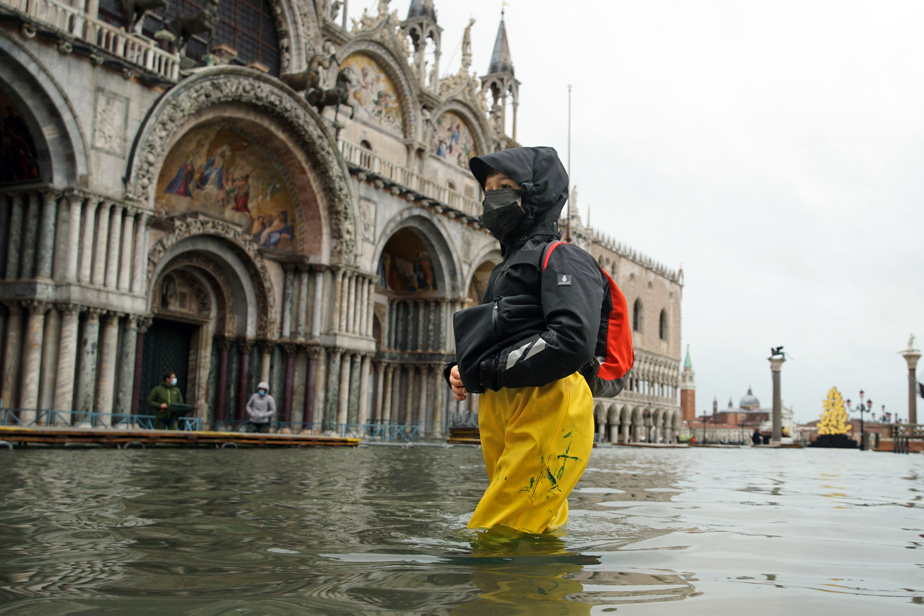
The City of the Doges is one of the first to have acted on the problem of rising waters. Since 2020, a system of barriers called MOSE (electromechanical experimental module) has been raised at the mouth of the Venice lagoon during exceptional tides, called acqua alta. MOSE notably protected Venice during a record-breaking 2m aqua alta last November. But recent modeling has shown that MOSE should be activated so often in 2100 that the lagoon is likely to have oxygenation problems.
To properly model flood risks, very precise data are needed. MM. Thompson and Hamlington praised data from the Canada-US SWOT satellite, launched last December, in Washington. In particular, it allows you to see ocean currents and loops of only 20 km in diameter.

