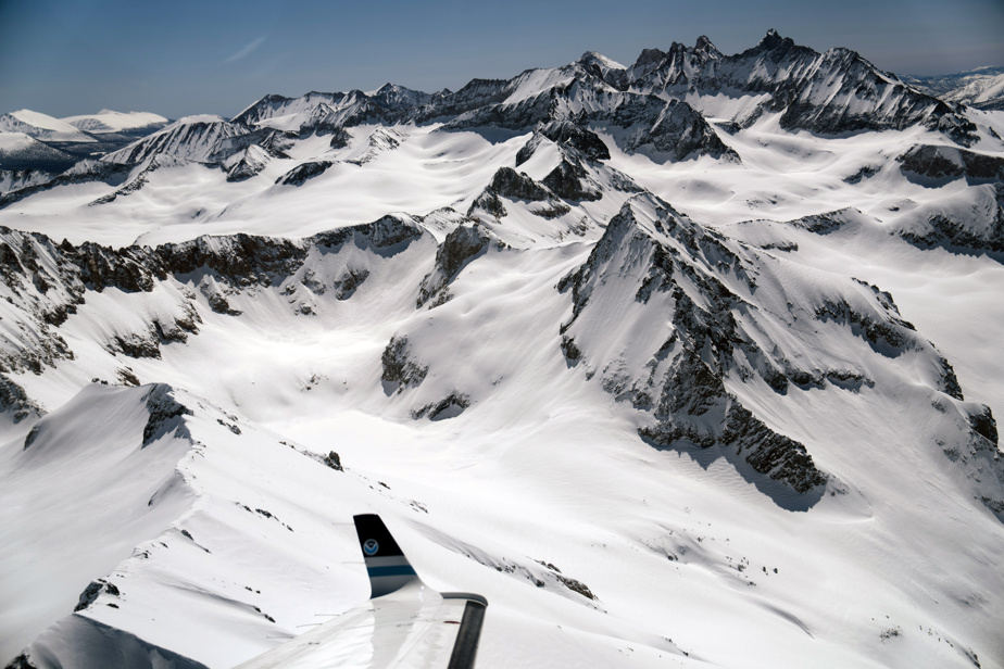
On the high slopes of the Sierra Nevada, the strong storms that hit California during the winter left behind a gigantic frozen reservoir. Its thaw will shape the next phase of what has already been a remarkably wet year for this drought-ridden state.
Snow, in the form of huge walls, blanketed the peaks and sides of the majestic Sierra Mountains, in amounts parts of the region had never recorded before.
Snow fell in quantities that defy imagination: 1660 cm at Mount Rose near Lake Tahoe, 1780 cm at Mammoth Mountain. Converting that precipitation to an equivalent amount of water, it’s nearly double the historical average at this point in the year in the northern Sierra, where runoff feeds several large reservoirs. In the southern Sierra, it is about three times the average.
Statewide, this season’s snowpack is on track to become the largest or second largest since modern records began in 1950, said Sean de Guzman, director of the Snow Survey and Water Supply Forecasting Unit of the California Department of Water Resources.
The vastness of the snowpack has sparked joy among skiers and a more complex mix of emotions among farmers and water managers, who are ready to take advantage of the abundance of water, but are also preparing to the possibility of more catastrophic flooding this spring.
Recent storms led Governor Gavin Newsom to lift some drought-related restrictions, but some areas are still struggling to meet their water needs, including rural communities in the Great Valley that depend on groundwater wells.
It is essential to determine the amount of snow that accumulates in the Sierra each winter. For a long time, authorities and forecasters achieved this by driving long metal tubes through the snow and weighing the icy core that lay there. Today, these low-tech measurements still provide an important baseline, but sensors mounted on low-flying aircraft provide a much more complete picture.
On March 31, a National Oceanic and Atmospheric Administration (NOAA) turboprop flew over the Sierra for five hours, using specialized instruments to measure the amount of water in the deep white carpets. Within minutes of being collected, the data was sent for use in forecasting river levels and flood risk.
“There hasn’t been a lot of snow in the Sierra in recent years,” said Carrie Olheiser, a snow hydrologist with research organization RTI International, who assists with survey missions from the Sierra. NOAA snow. The comparison to this year’s levels, she says, is “night and day.”
For NOAA pilots, who must traverse steep backcountry terrain while staying low to the ground at 500 feet, a study of the snow involves a healthy dose of adventure. As they made their way through the narrow valleys, the plane’s navigation system played a loud stream of alerts offering to help them land – or avoid crashing into the mountains.
The big question facing California today is how quickly all that snow will melt and pour into, or even submerge, the state’s rivers and reservoirs – which is becoming increasingly difficult to forecast as the planet warms.
In general, the slower the snowmelt, the less water there is in rivers, says Noah P. Molotch, a hydrologist at the University of Colorado at Boulder.
How is global warming changing the game? In the West, the snow seems to be melting earlier in the spring, which could slow the thaw and allow less melted snow to reach the rivers. But earlier melting could also mean the thaw is happening when the air isn’t as warm and vegetation is less active. This would have the opposite effect: less melted snow would be absorbed by plants, and more water than usual would end up in waterways.
Molotch said he and other researchers are still “determining the relative importance of these two mechanisms.”
According to the most recent forecast from the California Department of Water Resources, Great Valley river flows through July will be at or above average in the Sacramento River Basin, but twice or more than average. further south in the Lake San Joaquin and Lake Tulare basins.
Another factor that will determine where the melted snow ends up is how dry the soil is. According to Dana A. Lapides, postdoctoral researcher in hydrology with the U.S. Forest Service, if the soil and bedrock below the slopes of the Sierra are dried out after years of drought, they will absorb more of the meltwater, leaving less for streams.
That’s what appears to have happened in 2021, when the Department of Water Resources vastly overestimated the amount of snow that would end up in waterways that winter. In a recent study, Lapides and her co-authors found that by accounting for soil dryness, the Department’s forecasts could have been much more accurate that year.
There isn’t enough data yet to say for sure how much of this year’s slush might be gobbled up by the ground, Lapides said. It has snowed so much in the Sierra lately that Forest Service officers have been unable to travel to some areas to measure soil moisture.
But Lapides’ preliminary estimates suggest that in parts of the region, this year’s storms have already filled in much of the ground below the slopes. Which could mean that much of the runoff will end up in reservoirs and irrigation systems.
Water managers view this prospect with caution. In the Central Sierra above the Tuolumne River, this season’s snow is about 2.7 million acre-feet of water, or 800,000 acre-feet more than what typically flows through the Central Sierra. river over the course of an entire year (an acre-foot of water would cover an acre of land, at a depth of one foot).

